2D Maps & WMS/WMTS Layers
Find the place on the map, then look at it in 3D. A SkyGIS project has a 2D map alongside the 3D viewer, with your orthophotos, drawings and asset layers on the map and WMS/WMTS services for the data you don't hold yourself: buried utilities, cadastral boundaries, environmental constraints.
- Services
- WMS and WMTS layers
- Basemaps
- Built-in, XYZ and Mapbox-style
- On the map
- Vectors, orthophotos, 2D versions of IFC and LandXML
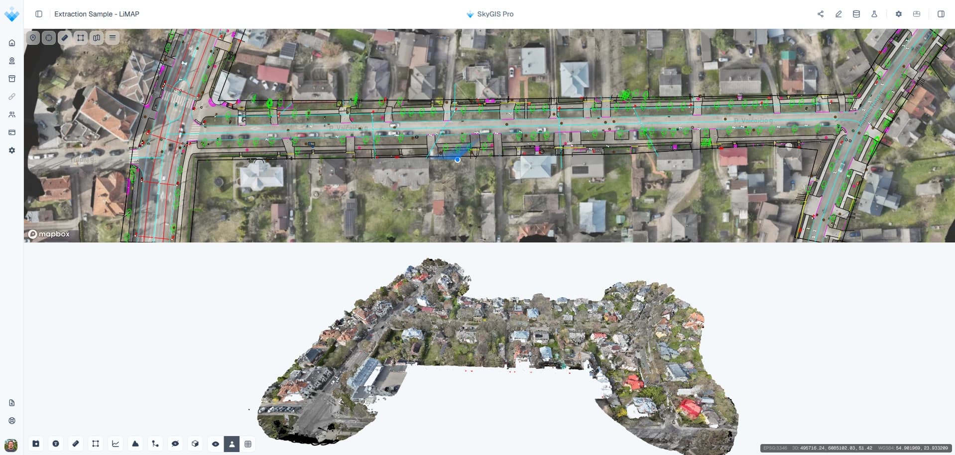
The 2D map and 3D view of one project
Choose a layout with the map and the 3D viewer together. The map is where you find things: a junction, a land parcel, a manhole. The 3D view is where you check levels and clearances against the scan or the model.
Select a feature in the 3D view and its record opens in the attribute table. Distances and areas can be measured on the map as well as in 3D.
Layers you can add to the map
- Service
WMS and WMTS
Connect external map services, such as underground utility records, cadastral maps or environmental constraints, and show them over the site.
- Basemap
XYZ tiles
An XYZ tile service as the background map, including one your organisation hosts.
- Basemap
Mapbox-style
A Mapbox-style basemap, if that is what your organisation already uses for its web maps.
- Project
Your own layers
Orthophotos, CAD and GIS files, and 2D versions generated from IFC and LandXML models.
Example
From the site plan to the scan
A project lead briefing a contractor on a junction upgrade starts on the map: the orthophoto as background, a WMS layer of buried services on top and the scheme boundary from a DWG.
When the discussion turns to levels and kerb heights, they click into the junction and move to the 3D view of the scan. Saved views keep the camera, basemap and visible layers, so colleagues on the project open exactly the same map afterwards.
Questions
Why combine a 2D map with the 3D survey?
Most briefings start with where: the site boundary, access, buried services. The map answers that with orthophotos, drawings and map services, and when the conversation turns to levels or clearances you move to the scan in 3D.
Can I bring our existing map services into SkyGIS?
Yes. WMS and WMTS services, such as utility or cadastral maps, draw on the project map with your survey, drawings and asset layers, and they're included in SkyGIS Viewer. Your organisation's own basemap can be added as an XYZ or Mapbox-style service.
Can I publish my SkyGIS project as a WMS service?
No. SkyGIS reads incoming WMS and WMTS services but doesn't serve your project data as one. Share the project through a link instead.
Does SkyGIS show Google Street View?
Yes, in SkyGIS Pro. Viewer works with your own panoramas.
Try it with your own data
The free plan includes one user and 5 GB of storage, with no credit card required. Upload a file and open it in your browser.