GIS Without
Boundaries
Bring point clouds, vector data, and imagery into one cloud-native platform. Viewer for collaboration; Pro for advanced use cases. Accessible anywhere, on any device.
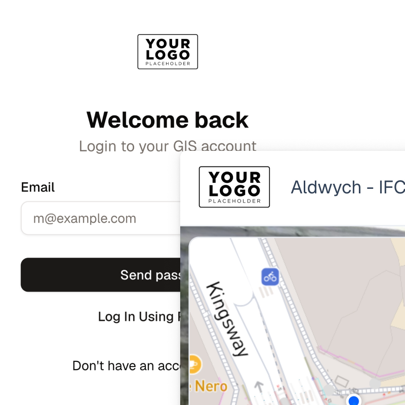
Already have an account? Log in here.
Live Demo
Experience SkyGIS
Explore a live project right in your browser. No installation required.
Open Live Demo
Explore the full interactive platform.
Click anywhere to launch
Platform Capabilities
Two products. One platform.
Viewer handles collaboration, measurement, and review. Pro adds analysis, processing, editing, and field-grade workflows on top. Both run in the browser.
SkyGIS Viewer
View, measure, share. Free to start.
SkyGIS Pro
Everything in Viewer, plus analysis, processing, and offline access.
SkyGIS Viewer
Starting tier
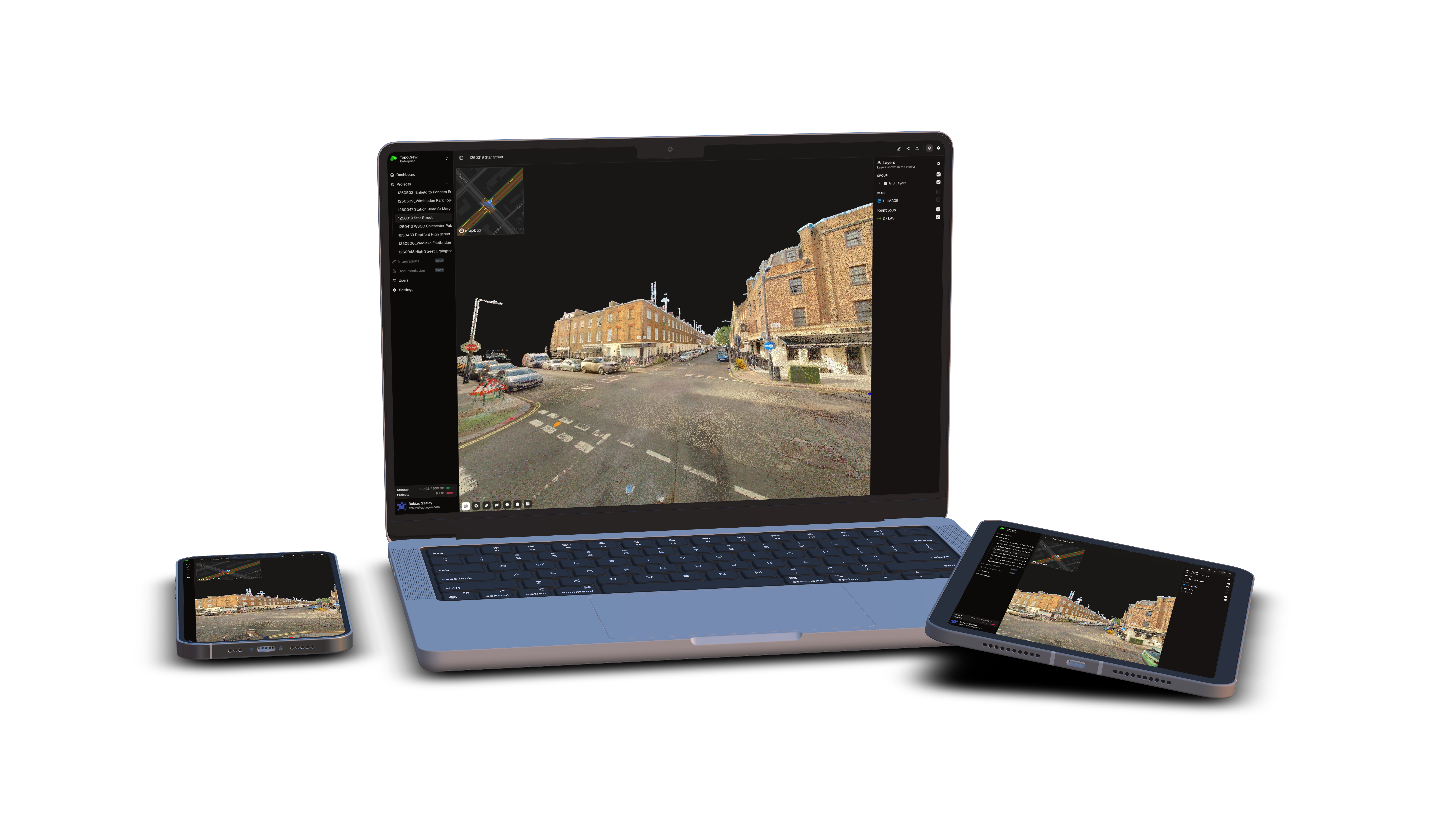
SkyGIS Viewer replaces desktop software with a single browser tab.
What you gain
- Instant access anywhere with a browser and internet
- Single source of truth for every stakeholder
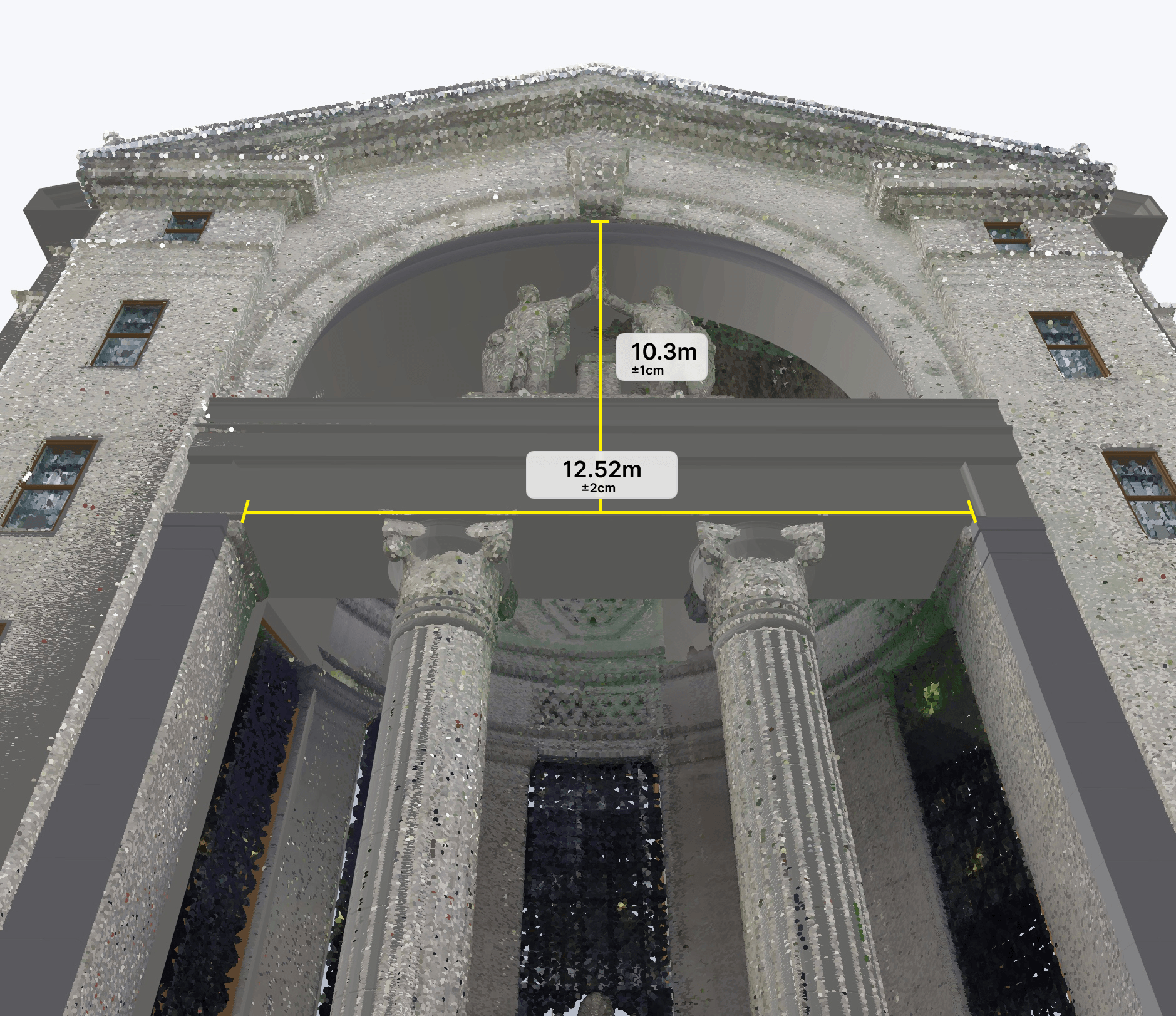
- Measure areas and distances directly in the browser, with no desktop software needed
- Share securely with password-protected links you control
- Scalable from megabytes to terabytes
- Present a fully branded experience to clients and stakeholders
Problems we solve
- Eliminate expensive desktop software, high-end hardware, and IT approvals.
- Stop shipping hard drives. Share password-protected links instead.
- Get area and distance measurements on-site without waiting for the office.
- Replace restrictive local storage with scalable, high-performance cloud infrastructure.
- Synchronize field teams and stakeholders through streamlined web workflows.
- Drop branded white-label viewing into client deliverables instantly.
Survey & Production Support
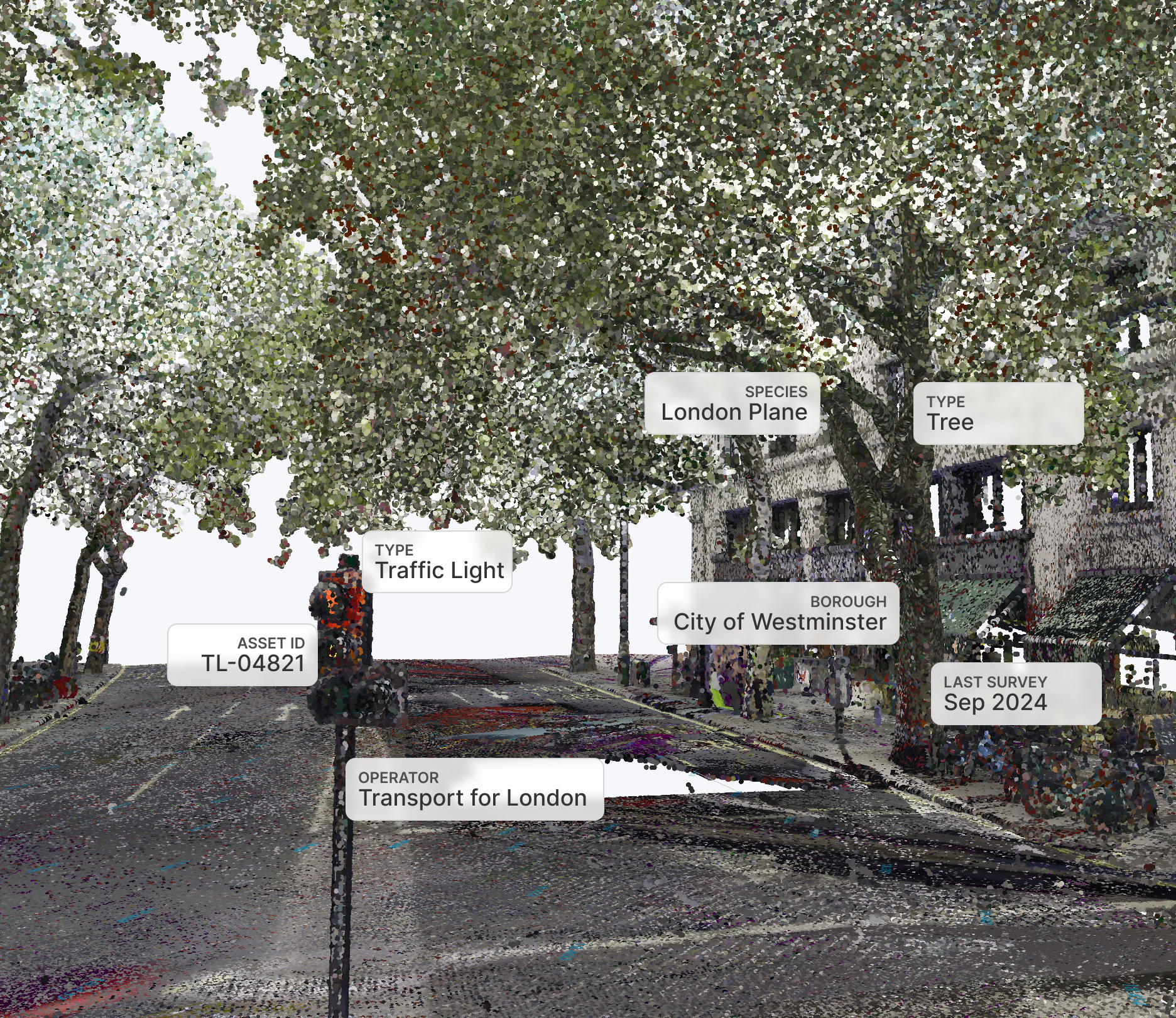
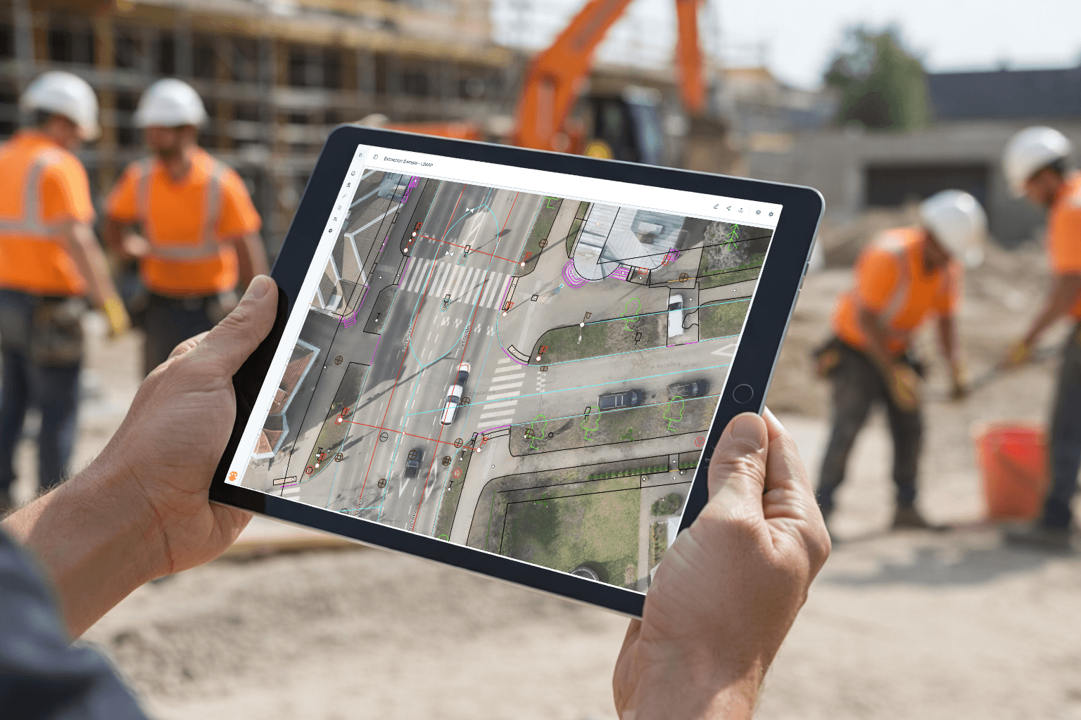
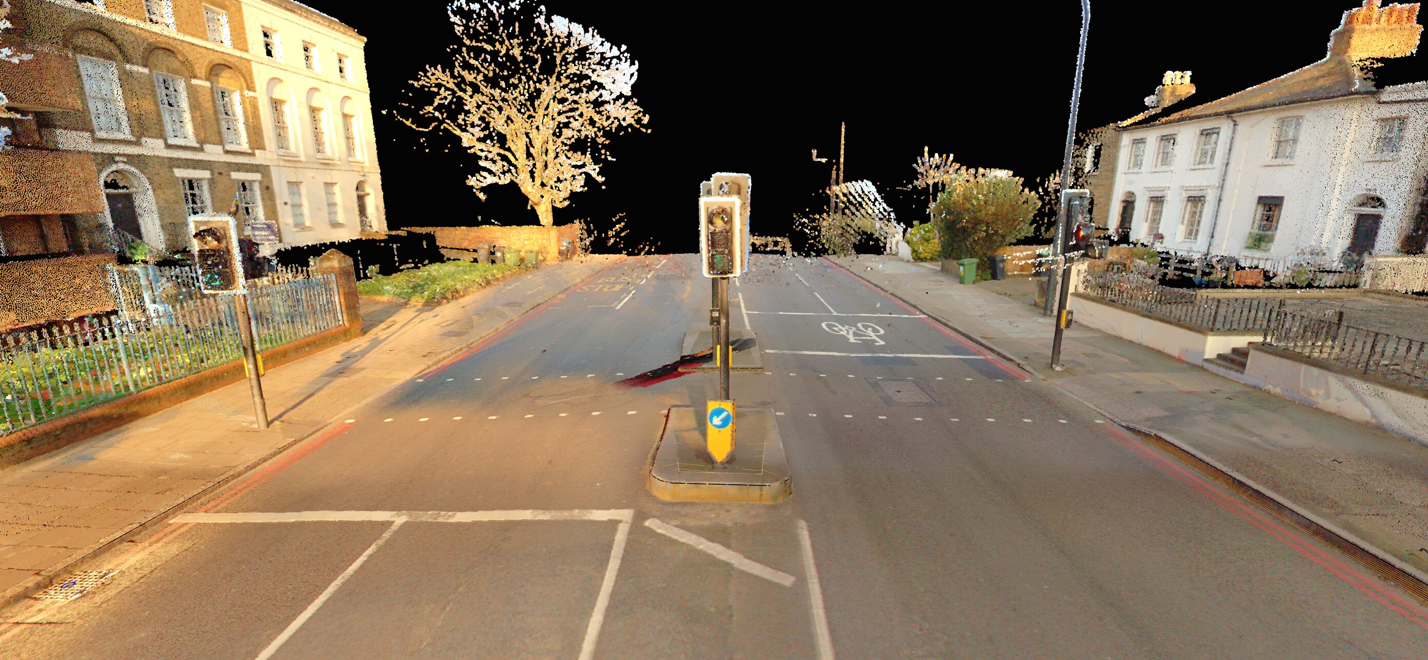
Inspect point clouds, browse scan imagery, and check vectors and designs in the standard workflow for land surveyors and GIS professionals. Everything runs in the browser with zero installs.
- Visual QA directly on the point cloud
- Upload and overlay vectors for verification
- Built-in measurement tools for distance and area
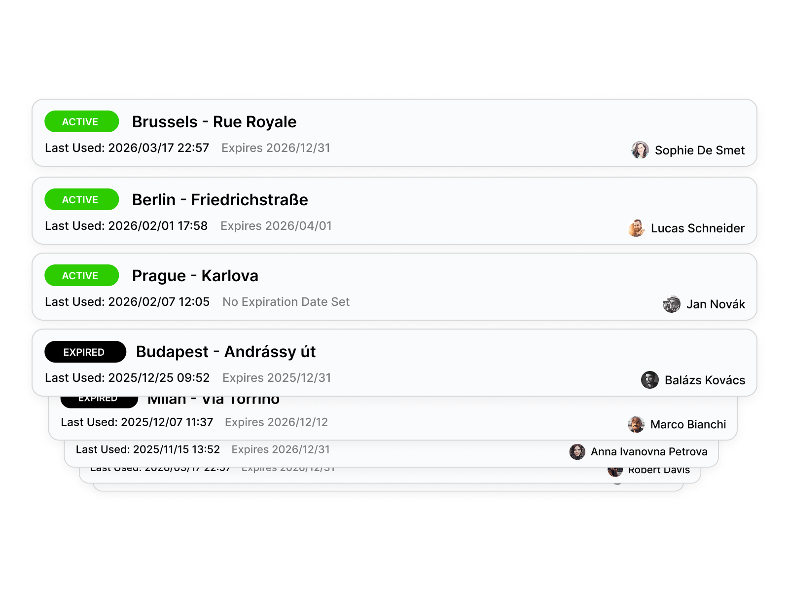
Project Sharing
Share projects with clients, reviewers, and stakeholders through a simple link. No installs, no accounts. They open it and see the data immediately.
- One-click sharable links with expiry control
- No registration required for recipients
- Full interactive 3D experience
Scanner Sales & Demos
Upload data from various scanners and run live demos in the browser. Fast, visual, and easy to share.
Heritage Conservation
Store and share scanned heritage sites. Unified access for researchers, architects, and conservation teams.
Crime Scene Investigation
Standardize how scanned crime scene evidence is reviewed across teams and jurisdictions.
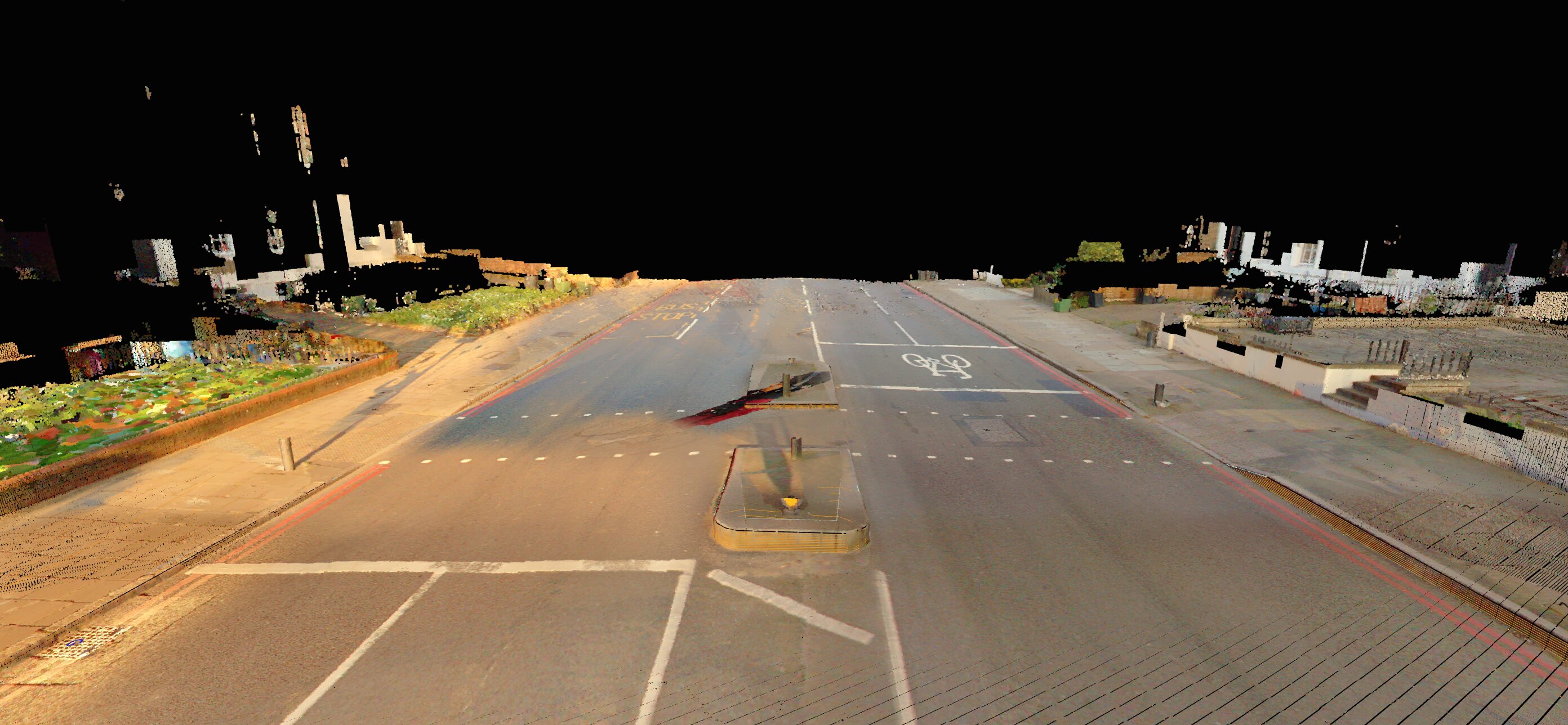
Raster from Point Cloud
Create raster images from top-down views for a comprehensive overview of your point cloud.
Plantation Management
Combine UAV datasets with GIS layers of individual trees for precision agriculture and forestry.
Public-Facing Portal
Enable the public to explore citywide geospatial data through a simple and engaging interface.
Our Mission
The new standard for spatial data
Built for surveyors, engineers, mapping specialists, and professionals who need to upload, view, and collaborate on massive datasets without local processing or complex setup.
From E57 point clouds to GeoTIFF imagery, everything runs instantly in the browser.
Trust & Compliance
Security by design
Your data is encrypted at every layer, isolated in private networks, and stored with full redundancy in European data centers.
Encrypted everywhere
AES-256 encryption at rest for every file and database record, plus TLS-secured connections in transit.
Signed & expiring links
Shared links are cryptographically signed with built-in expiration and optional password protection. No one accesses your data without authorization.
Redundant & backed up
Your data is replicated across multiple availability zones with automated daily backups and point-in-time recovery.
EU-hosted infrastructure
All data is processed and stored in European data centers. Backend services are fully isolated from the public internet.
Versioned storage
Every file upload is versioned automatically. Accidental overwrites or deletions are recoverable.
Built for durability
Intelligent storage tiering keeps your data cost-efficient and instantly accessible, from megabytes to terabytes.
SkyGIS Pro
Enterprise tier
SkyGIS Pro adds analysis, processing, editing, and field-grade tooling.
 RawProcessed
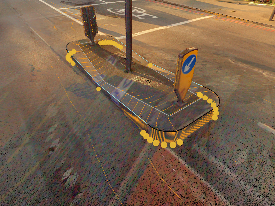

 OriginalBlurred
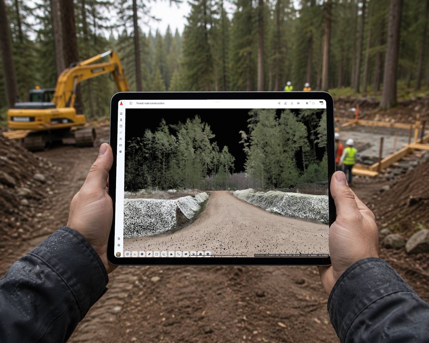
What you gain
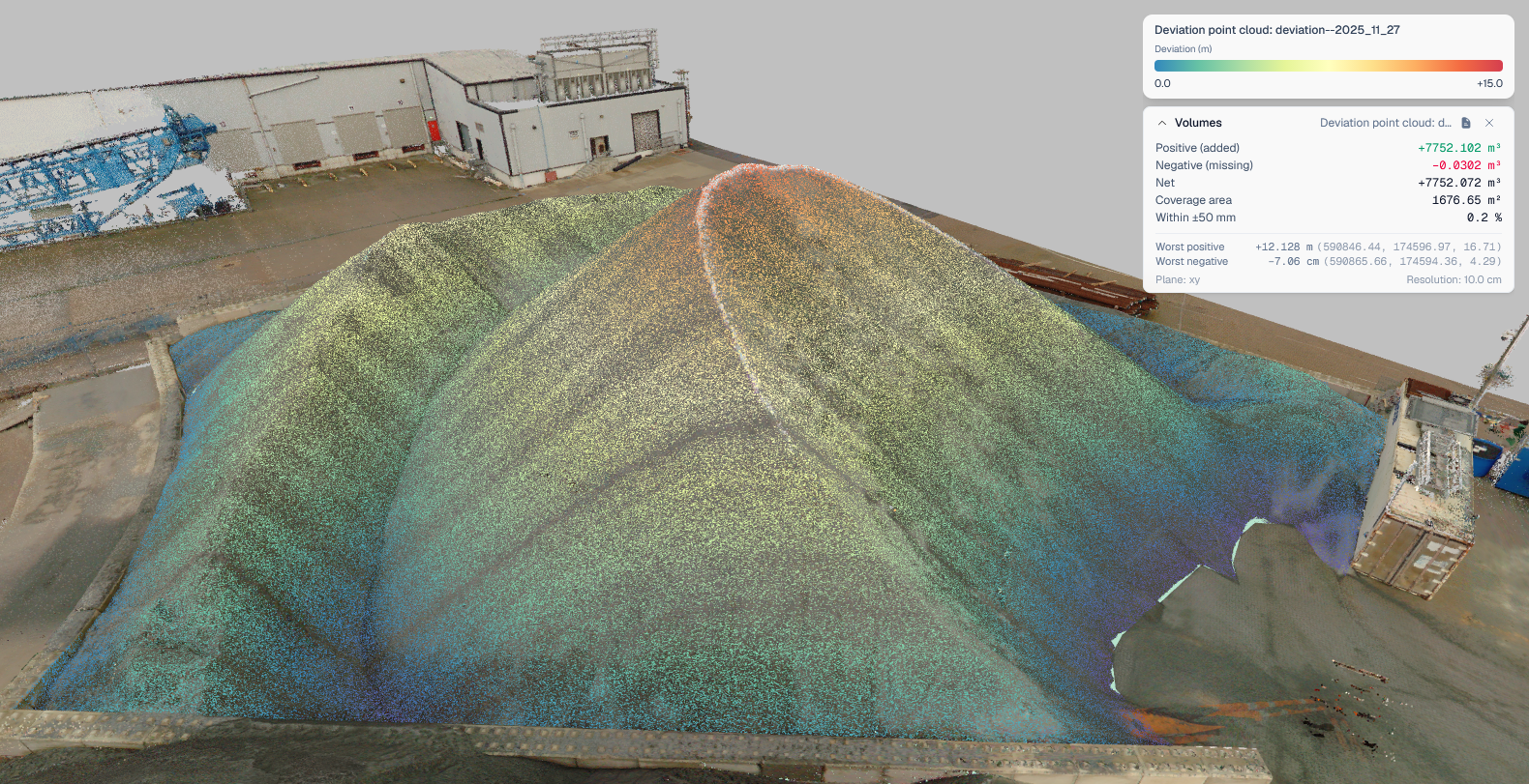
- Move volume, stockpile, and deviation analysis off the desktop
- Generate ortho images, classify ground, and edit vectors in one place
- Convert formats and archive projects without external tooling
- Stay compliant with automatic face and license-plate blurring
Problems we solve
- Replace stockpile and earthwork calculations in heavy desktop software.
- Stop shuffling files between RCS, LandXML, IFC, and standard formats.
- Avoid manual blurring for privacy compliance on streets and sites.
- Keep working in the field when connectivity drops.
Earthwork Volume Tracking
Track stockpile quantities, cut and fill, and terrain changes with survey-grade precision directly from UAV or terrestrial point clouds. Monitor progress against design intent for accurate billing.
Quarry & Mining Progress Monitoring
Use stockpile calculation and selection tools to measure extracted material per zone across time. Combine UAV point clouds with WMS layers for regulatory reporting.
BIM / AEC Coordination
Combine IFC models with point cloud scans to detect clashes, verify as-built conditions, and coordinate between design and construction teams in one shared browser environment.
Road & Rail Infrastructure Inspection
Load LandXML alignments alongside point cloud surveys to verify earthwork geometry, check clearances, and document deviations from design. Ideal for linear-asset managers.
Compliance & Long-Term Retention
Archive large point clouds at a fraction of their original cost for multi-year preservation. Instantly restore when needed for audits or regulatory reviews. Auto-blur faces and license plates to stay compliant with privacy rules.
Survey-to-Deliverable Pipeline
Run format conversions, vector editing, and point cloud manipulation in a single platform, reducing external desktop tooling and supporting delivery from raw scan to final client output.
Offline Field Work
Take projects offline for field inspections in low-connectivity sites. Capture observations, then sync back when you reconnect.
Utility Network Management
Overlay utility layers with point cloud site surveys to plan excavations safely, identify conflicts, and document as-built underground infrastructure.
Branded Client Deliverables
Present data to external stakeholders in a fully branded viewing environment that reinforces professionalism during project reviews and public consultations.
Pricing
Two products. One platform.
Viewer for collaboration and review. Pro for processing, analysis, and field-grade workflows. Pick the one that fits your team.
SkyGIS Viewer
View, measure, share. Everything you need to collaborate on spatial data in the browser.
Free
Free
1 user
5 GB
Starter
€50/mo
3 users
100 GB
Team
€200/mo
5 users
500 GB
Business
€300/mo
10 users
1 TB
Included
- All scanner types (TLS, MLS, ALS, ULS, SLAM)
- Point cloud formats (LAS, LAZ, E57, ASCII)
- Vector formats (DXF, DWG, SHP, GeoJSON, KML, KMZ, GPKG)
- BIM & model formats (IFC, LandXML)
- Ortho formats (GeoTIFF, JPEG 2000)
- Panoramic image support
- Sharable links (password-protected)
- Measure (distance, area)
- Screenshots
- Clip box
- Attribute table
- Project management
- Custom branding
SkyGIS Pro
Everything in Viewer, plus analysis, processing, editing, and offline access for advanced use cases.
Pricing
Custom packages
Designed around your team size, storage, and workflow.
Included
- Everything in Viewer
- Stockpile calculation
- Plane, model & point cloud deviation
- Volume calculation
- Elevation profile
- Ground classification
- Point cloud thinning
- Ortho & raster generation
- Format conversions
- Vector feature editing
- RCS point cloud support
- Google Street View support
- Clip box export
- Archive function
- Face & license plate blurring
- Offline project availability
- Custom branding
Full feature comparison
| Feature | Viewer | Pro |
|---|---|---|
| Data & Formats | ||
| Scanner types (TLS, MLS, ALS, ULS, SLAM) | ||
| Point cloud formats | LAS, LAZ, E57, ASCII | LAS, LAZ, E57, ASCII, RCS |
| Splat formats | Xgrids, PLY, SOG, SPZ | Xgrids, PLY, SOG, SPZ |
| Vector formats | DXF, DWG, SHP, GeoJSON, KML, KMZ, GPKG | DXF, DWG, SHP, GeoJSON, KML, KMZ, GPKG |
| BIM & model formats | IFC, LandXML | IFC, LandXML |
| Ortho formats | GeoTIFF, JPEG 2000 | GeoTIFF, JPEG 2000 |
| Panoramic image support | ||
| View & Share | ||
| Project management | ||
| Sharable links | ||
| Screenshots | ||
| Clip box | ||
| Clip box export | ||
| Attribute table | ||
| Edit vector features | ||
| Custom branding | ||
| Offline project availability | ||
| Measure & Analysis | ||
| Distance & area measurement | ||
| Elevation profile | ||
| Stockpile calculation | ||
| Volume calculation | ||
| Plane / model / point cloud deviation | ||
| Processing | ||
| Ground classification | ||
| Point cloud thinning | ||
| Ortho & raster generation | ||
| Format conversions | ||
| Face & license plate blurring | ||
| Archive function | ||
| Integrations | ||
| Google Street View | ||
Don't see what you need? Submit a feature request.
Contact
Get in touch
Have questions or want a live demo? We'd love to hear from you.
Or email us directly at
hello@skygis.cloud