Don’t Let Your Scanner Choose Your Software
Why a hardware-independent workflow gives survey and construction teams the freedom to use the right capture device and the right software for every job.
Choose the Scanner for the Project
You choose a scanner based on the project. You choose software based on the scanner. But what if the workflow could work the other way around?
Organisations of every size often use equipment from several manufacturers. When a scanner is purchased, its associated software ecosystem naturally becomes part of the workflow, especially for initial processing. Turning raw scan data into a usable point cloud generally means working in the manufacturer's environment.
But once that point cloud has been created, the question changes: which software should handle post-processing, analysis, visualisation, and sharing?
Manufacturer software can be highly capable, but it is not the only option. The challenge grows when a team works with scanners from multiple manufacturers, each with its own workflow, formats, and compatibility constraints.
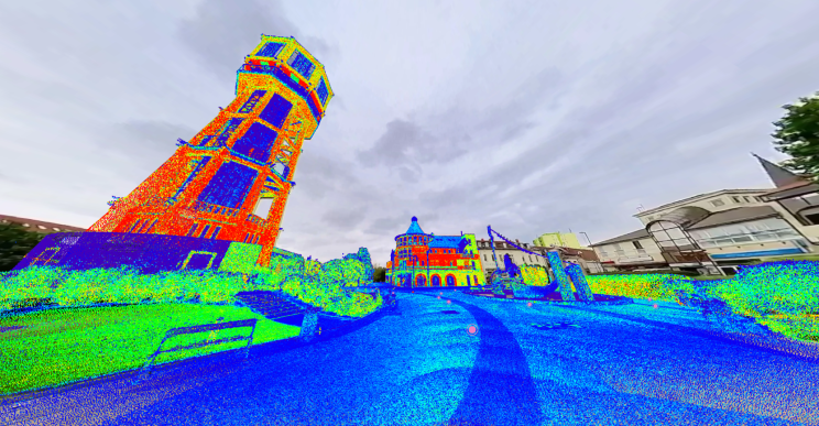
Panoramic images from an FJD Trion S2 scanner. Image: 3D Geosolutions.
The Hidden Cost of Vendor Lock-In
Vendor lock-in is not only about whether a platform can read its own data. The more significant cost often becomes visible in the day-to-day workflow that forms around the equipment.
One dedicated environment may work well. Add a second manufacturer, then a third, and the simplicity starts to fade. Each platform can introduce its own licensing model, interface, training needs, sharing method, and file structure. Teams may have to learn several environments to perform similar tasks; projects can become fragmented; data may need conversion before it can be reused; and maintaining a consistent project structure becomes harder.
The hidden costs are real: time spent learning systems, moving and converting data, storing duplicates, training staff, and paying for several software ecosystems. Most importantly, there is the added complexity in the workflow.
A Tale of Two Scanners
Imagine an organisation using a Trimble mobile-mapping system alongside a Leica terrestrial laser scanner. Both are excellent technologies, but they come from different ecosystems and toolsets.
Where should the data be stored and shared? Which system should the team learn? What happens when a project needs data from both devices?
Neither manufacturer's environment has to be a poor choice; specialist software can be powerful and well optimised for its hardware. The problem is that the project itself does not necessarily care which manufacturer captured its data. The team still has to manage the separation.
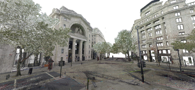
Point cloud from a Leica RTC360 scanner. Image: TopoCrew.
One group may favour the Trimble workflow while another is more familiar with Leica. When their data needs to meet, conversion steps or workarounds can appear. A sensible decision to use the best scanner for each job can turn into parallel workflows, separate skill sets, and different approaches to managing the same kind of spatial data.
Vendor lock-in then becomes a workflow limitation, not merely a technical one.
What Happens After the Point Cloud?
The scanner is only the beginning. Pre-processing is often closely connected to the manufacturer's ecosystem: raw data must be registered, processed, and exported with the appropriate tools. When this step already works, there is usually little reason to change it.
Once the point cloud is ready, however, the workflow can be different.
SkyGIS provides a common working environment for data from different manufacturers and sensor types. Teams can continue capturing with the systems that suit their work—whether Trimble, Leica, Riegl, DJI, FJD, CHCNAV, South, or another supported system—then bring the processed data into SkyGIS for the next stage.
The hardware can be different. The data can be different. The working environment does not have to be.
That is the value of reducing vendor lock-in: it does not replace the tools that already work. It gives teams more freedom to decide what happens after the scan.
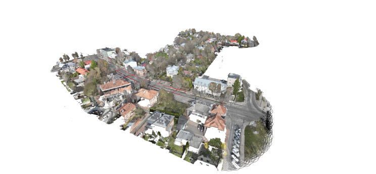
DJI point cloud with extracted vectors. Image: LiMAP.
Mix and Match the Right Tools
The aim is not to replace every tool in a workflow. That would rarely be practical or desirable. People in the same organisation often have different specialisms and software preferences, while the post-processing ecosystem contains many excellent applications built for specific tasks.
Experienced professionals tend to solve a problem with as few tools as possible, but no single application can do every task efficiently. Engineers should be able to select the tool that best fits the problem.
SkyGIS is designed to complement existing desktop applications and manufacturer software. Use specialised tools where they are strongest; use SkyGIS when a common place is needed for visualisation, measurement, analysis, collaboration, or sharing—regardless of where the data originated.
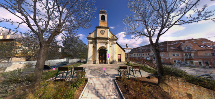
Panoramic imagery with point cloud from a Trimble X9 scanner. Image: 3D Geosolutions.
This flexibility and interoperability let teams mix and match the tools that best serve their projects while keeping spatial data available in a shared environment. The best workflow is not necessarily the one with the fewest tools. It is the one that gives the team the freedom to use the right tool for the right task.