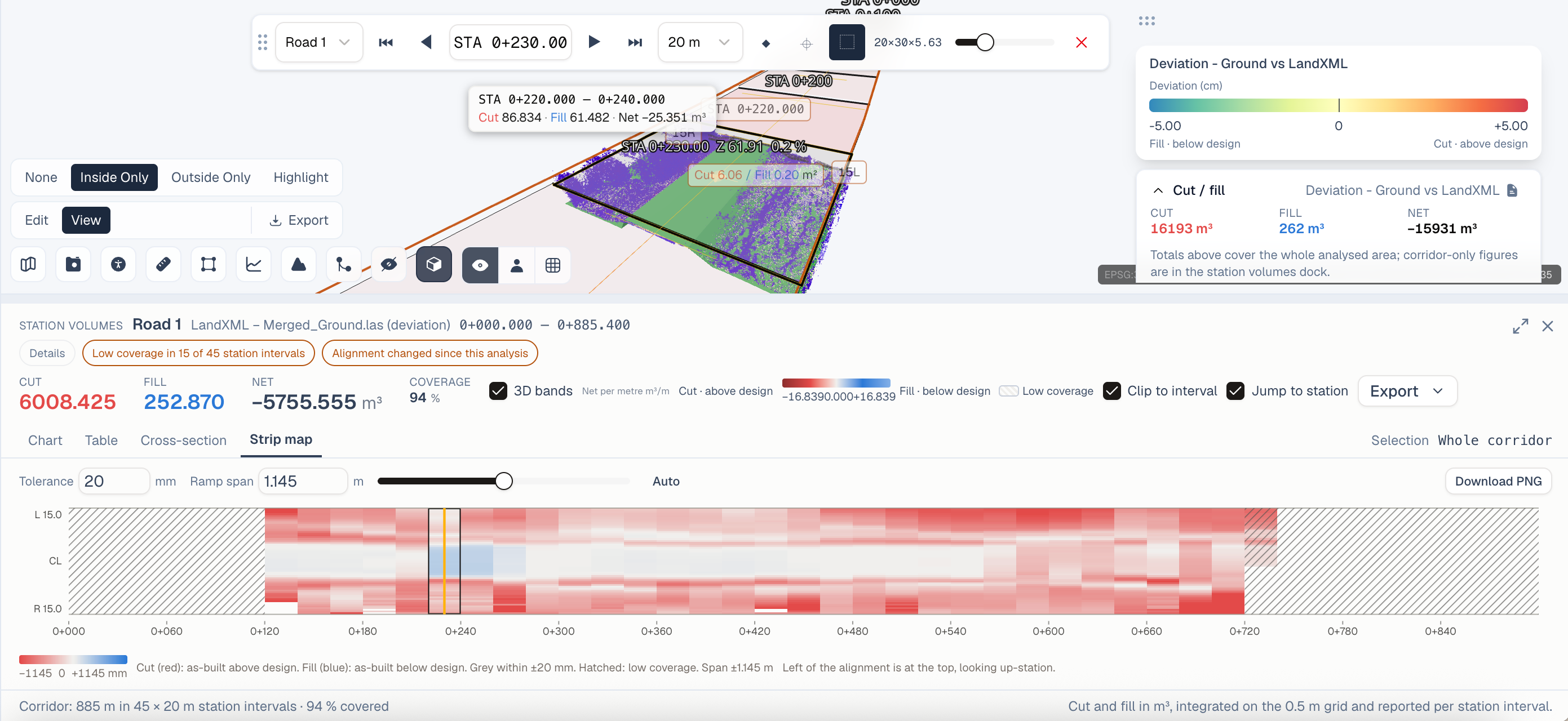
SkyGIS Viewer: Practical Geospatial Collaboration in the Browser
Explore how SkyGIS Viewer helps teams view, share, compare, and communicate point clouds, imagery, vector data, and project context without desktop software.
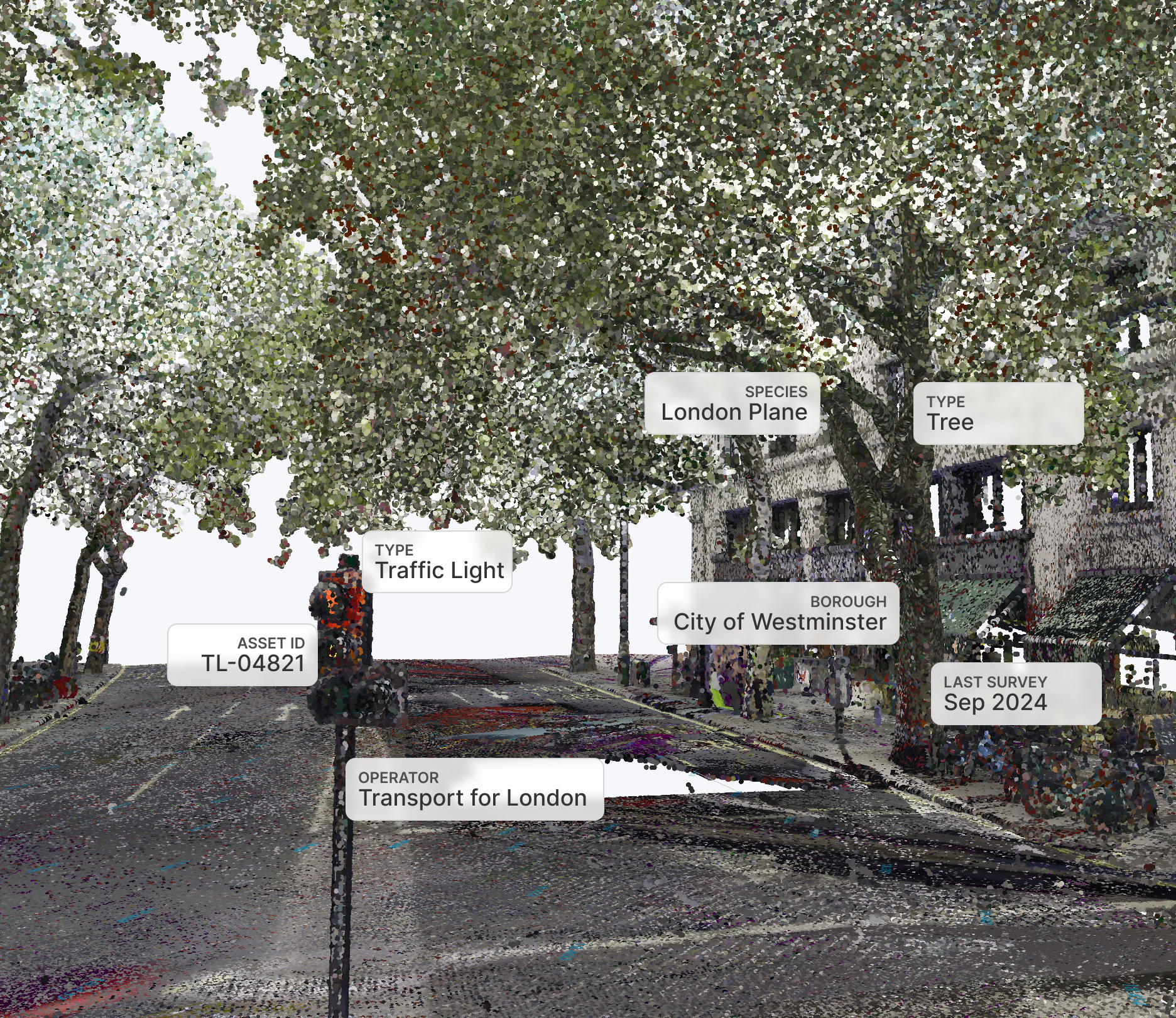
Built for Everyday Spatial Work
SkyGIS Viewer is the entry-level package within the SkyGIS platform, designed to make geospatial data easier to view, explore, and share. It gives teams an affordable way to work with point clouds, imagery, vector data, and other spatial information in one browser-based environment.
That matters because many geospatial workflows still depend on specialised desktop software, powerful local hardware, and large file transfers. SkyGIS Viewer removes much of that friction so surveyors, designers, clients, and project partners can work from the same project without needing the same technical setup.
Hardware-Independent by Design
One of the key advantages of SkyGIS is complete hardware independence. Teams are not tied to a specific laser scanner, camera system, or capture ecosystem.
Whether your data comes from terrestrial laser scanning, mobile mapping, UAV photogrammetry, or another reality capture workflow, SkyGIS provides a shared environment where datasets from multiple sources can be visualised and reviewed together.
With support for an expanding range of industry-standard formats and data sources, organisations can combine point clouds, panoramic imagery, orthophotos, vector data, and model information in a single collaborative workspace.
Support Your Production Team
During most laser scanning projects, the data processing team is not present on site. They depend entirely on the information collected during the survey, and in many situations contextual imagery can become just as valuable as the point cloud itself.
A point cloud provides an accurate, measurable representation of the environment. Photographs and panoramic imagery add the human context needed to understand complex locations, interpret details, and make better decisions.
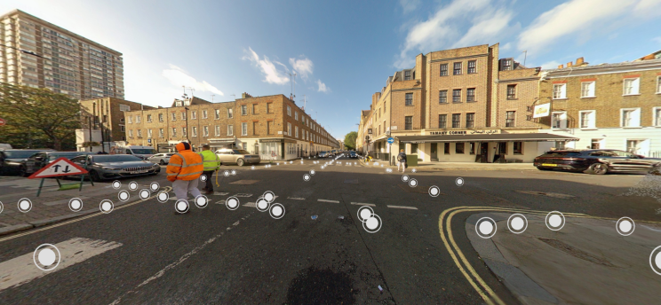
SkyGIS Viewer allows users to switch between panoramic imagery, point clouds, and vector datasets within the same project. This gives production teams a way to virtually revisit the site, investigate data from multiple perspectives, and extract information more efficiently.
Share Projects Without Friction
SkyGIS Viewer allows projects to be shared with colleagues, clients, and external partners in just a few clicks. Because everything runs directly in a web browser, there is no need to install specialised desktop software or exchange large datasets.
Even users with little or no experience in point cloud processing can confidently navigate a project using panoramic imagery or explore the 3D point cloud through an intuitive interface.
Cloud-based access also reduces common collaboration problems, including hardware limitations, software compatibility issues, and unsupported file formats. Projects can be shared securely using password-protected links, keeping access limited to authorised users.
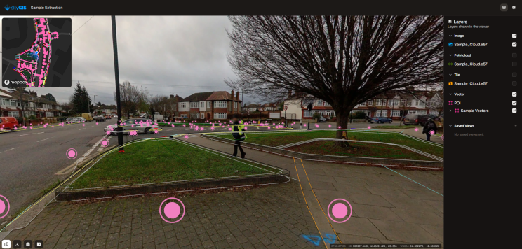
Bring Stakeholder Data Into One Project
One particularly powerful collaboration feature is the ability for invited users to upload their own datasets directly into a shared project. This allows multiple stakeholders to compare and review information from different sources in one place.
Consider a typical workflow. A surveyor completes a site survey and generates vector mapping from the captured point cloud. Instead of sending deliverables as separate files, the surveyor shares the full project through SkyGIS Viewer.
The receiving designer can then upload an IFC model and immediately compare the proposed design with surveyed reality, alongside the point cloud, panoramic imagery, and vector data.
By bringing all project information together in one workspace, SkyGIS Viewer streamlines communication, accelerates decision-making, and helps reduce misunderstandings throughout the design process.
Monitor Site Changes Over Time
Monitoring is one of the most common applications of reality capture. Infrastructure, buildings, and construction sites are frequently surveyed to document change and measure progress over time.
Each point cloud represents a precise snapshot of a site at a particular moment. When surveys are repeated over weeks, months, or years, they create a valuable historical record for change detection and progress review.
SkyGIS Viewer allows users to organise repeated surveys into folders, making it simple to manage multiple acquisition dates and navigate between different versions of a project. Historical and current datasets can be compared quickly to monitor progress, identify changes, and review project development.
Because projects remain securely accessible in the cloud, there is no need to distribute large point cloud files after every survey. Upload the latest dataset to the existing project, and everyone with permission can immediately access the most up-to-date information.
Highlight Important Project Details
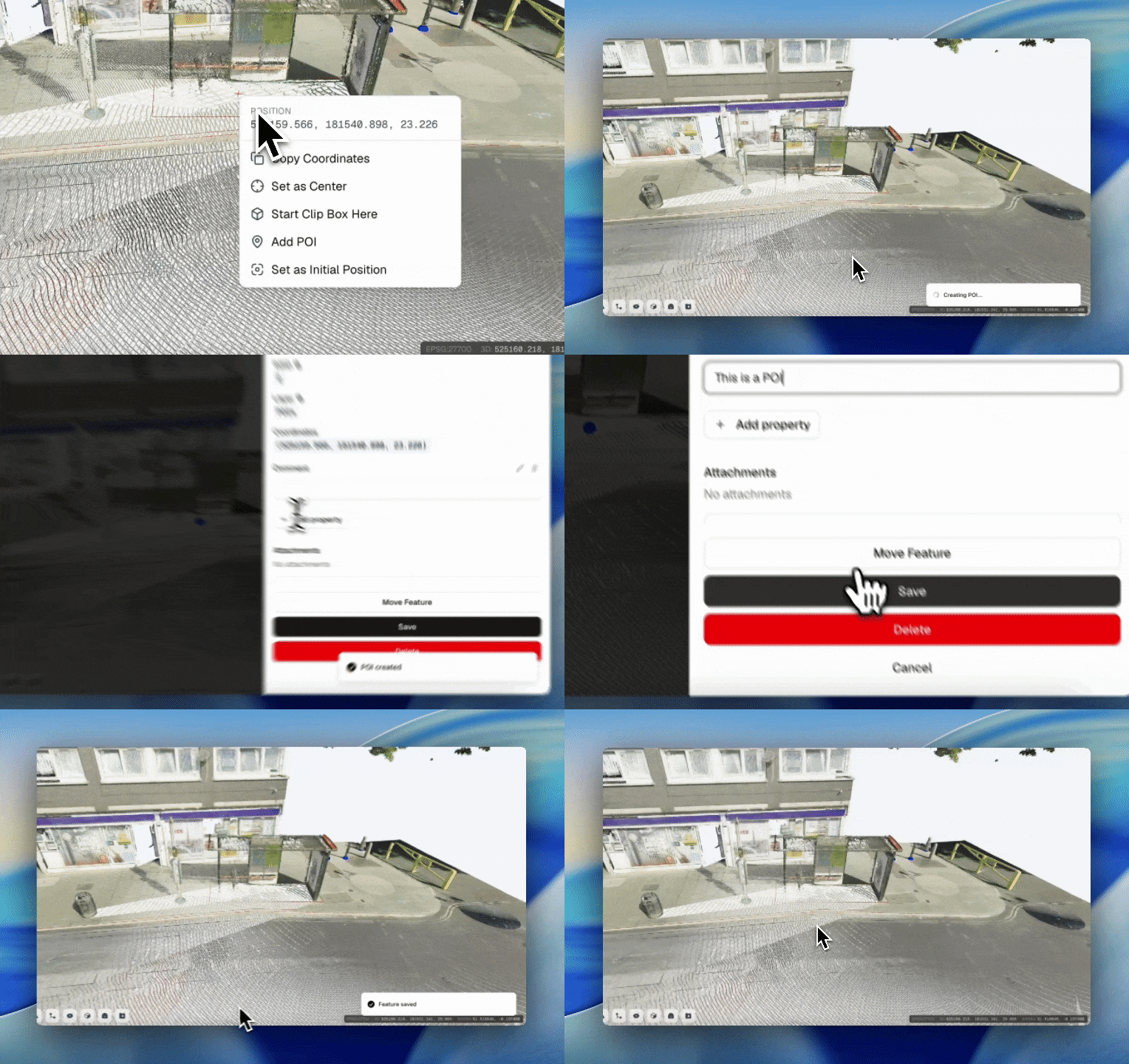
SkyGIS Viewer allows users to create Points of Interest (POIs) to identify important locations within a project. These can be reviewed in an attribute table, exported for further use, or opened instantly with a single click.
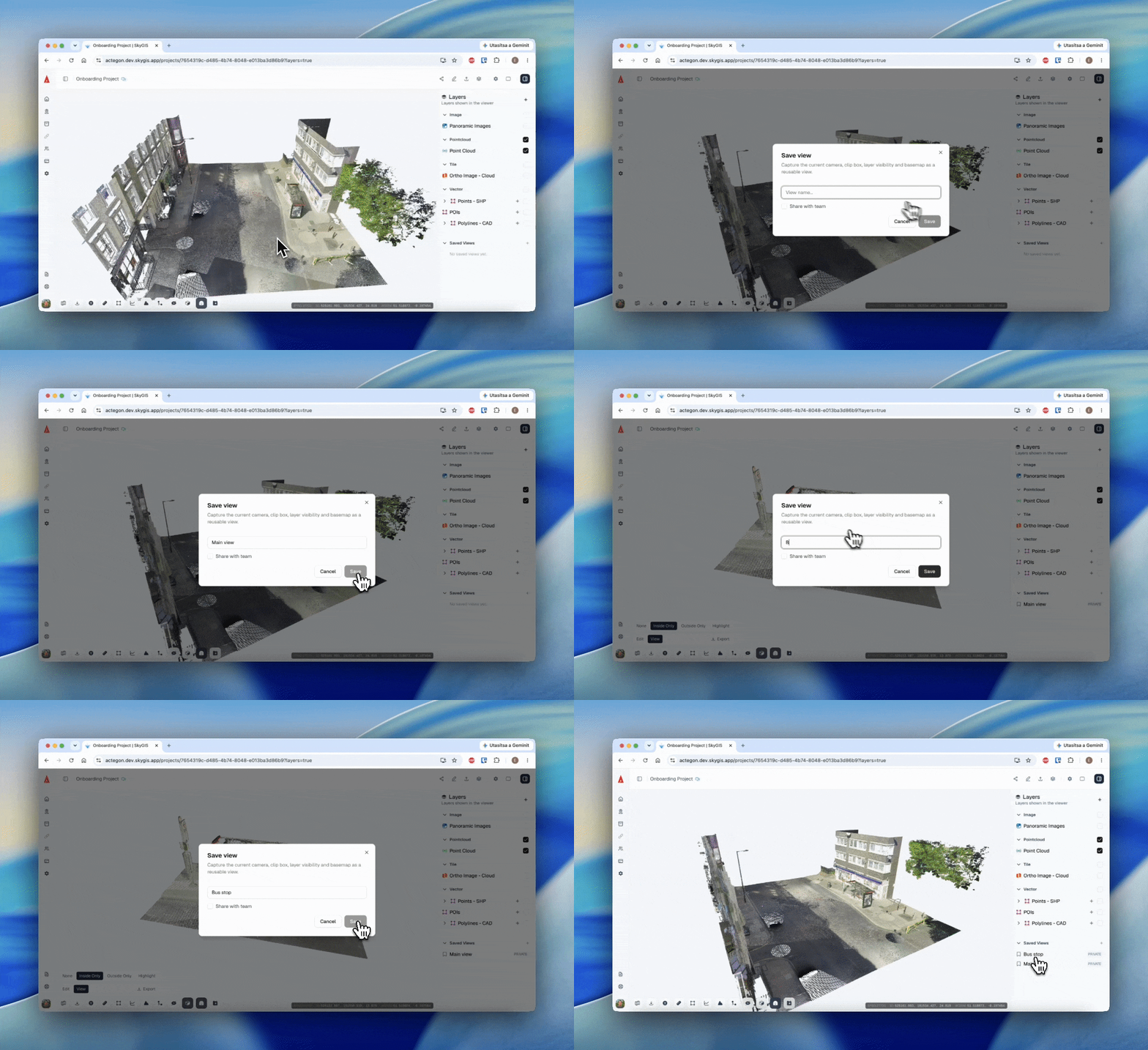
But a marker alone does not always provide enough context. SkyGIS also allows users to save custom viewpoints that preserve the location, active layers, and exact camera position.
When another user opens a saved view, they see the same perspective as the person who created it. This makes it easier to highlight important details for colleagues, clients, and project partners who may have limited experience navigating complex 3D environments.
Instead of relying on screenshots or long explanations, teams can share the exact viewpoint directly inside the project.
Calculate Stockpile Volume and Mass
SkyGIS Viewer enables users to perform stockpile calculations directly from point cloud data, regardless of the original data source or file format.
The workflow is straightforward: define the calculation area, choose the desired resolution, and, if required, specify the material type. SkyGIS then calculates both stockpile volume and estimated material mass.
This turns existing survey data into practical business information without requiring additional processing software or specialist workflows.
A Free Plan for Individuals
SkyGIS Viewer includes a fully featured 30-day free trial. When the trial ends, users do not lose access to the platform. They can continue using SkyGIS with the complimentary single-user plan, which includes 5 GB of cloud storage and access to the platform's full functionality.
Although 5 GB may appear modest, its practical capacity depends on the type of data and processing workflow. By combining optimised point clouds with vector data, imagery, and orthophotos, users can manage surprisingly large projects within the available storage.
The free plan is ideal for freelancers who want to showcase their work, small businesses collaborating with clients, and students or researchers looking for professional geospatial tools for academic projects and dissertations.
Start Exploring SkyGIS
If you would like to discover what SkyGIS can do for your organisation, start with the free 30-day trial at skygis.cloud.
Once the trial ends, you can continue using the platform with the complimentary single-user plan, making SkyGIS an accessible solution for professionals, businesses, and students alike.